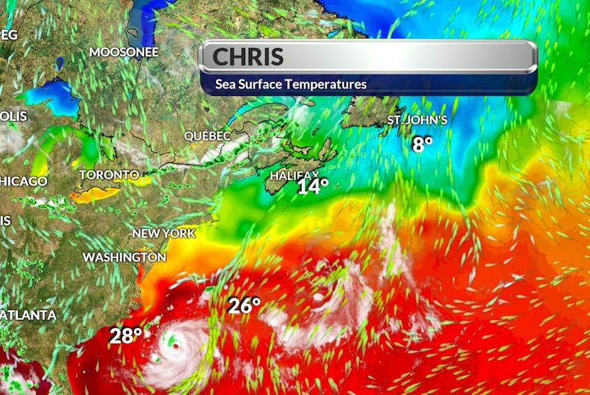
Last Friday, July 6, a cyclone formed off the Carolina coast. By Saturday, it had become a tropical depression and, by early Sunday, it was tropical storm Chris. The third named storm of the Atlantic hurricane season is now a hurricane.
Let’s start with the term “cyclone.”
A cyclone is defined as a large-scale, atmospheric wind-and-pressure system characterized by low pressure at its centre and by circular wind motion: counterclockwise in the Northern Hemisphere, clockwise in the Southern Hemisphere. When this takes place over the tropics, it’s a tropical cyclone.
When the maximum sustained winds in a tropical cyclone reach 62 km/h, the system becomes a tropical depression. When those winds range between 63 and 118 km/h, you have a tropical storm. If those sustained winds reach 119 km/h, a hurricane is born.
The Saffir-Simpson hurricane wind scale classifies hurricanes into five categories distinguished by the intensities of their sustained winds.
The highest classification in the scale, Category 5, consists of storms with sustained winds exceeding 251 km/h.
About 30 per cent of insurance losses around the world are related to tropical cyclones.
- Read more Weather University columns.
- Have a weather question, photo or drawing to share with Cindy Day? Email [email protected]
Cindy Day is the chief meteorologist for SaltWire Network.