It’s always difficult comparing two hurricanes, says a meteorologist with the Canadian Hurricane Centre.
But if you have a hunch that Dorian didn’t feel as bad as hurricane Juan, which walloped parts of Nova Scotia in September 2003, you may be on to something.
“One of the things we’re seeing (with Dorian) is how widespread the winds were,” Bob Robichaud said Sunday.
“With Juan, you look at some of the tree damage, some of the infrastructure damage, it was concentrated on a line to the right of the storm track, from Halifax right along the north shore and into Prince Edward Island.
“In this particular storm, the impacts were spread all over the Maritimes, southeastern New Brunswick, from one end to the other of Nova Scotia ... though the peak intensity wasn’t quite as high.”
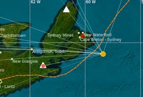
With Dorian, which made landfall just to the west of Halifax on Saturday evening, the heaviest rain was along the Atlantic coast near the metropolitan region, with amounts higher than 100 millimetres also common from the South Shore and into the Annapolis Valley, southeastern New Brunswick and western P.E.I., Robichaud said.
The worst winds of the storm system didn’t make it to shore, he said.
“We know that there was an area of stronger winds to the south of the storm, as it went by,” Robichaud said. “That area of strongest winds did not quite reach Halifax, although winds did reach well into the hurricane-force category.”
Dorian’s peak winds were not as strong as Juan’s.
“McNabs Island here, we recorded a gust of 178 kilometres per hour with Juan,” Robichaud said.
“The peak that I saw so far was around 145 with Dorian.
“Spread out over a much larger area, which is consistent with what we see in a post-tropical storm as opposed to a pure hurricane.”
Dorian was declared a post-tropical storm before making landfall, Robichaud said.
“It can be just as intense, just as powerful, but the structure is different. The meteorological labelling of it unfortunately causes confusion, especially when it changes right before landfall.”
Dorian was no lightweight for Nova Scotia Power. Its dimensions meant more problems for the power company, according to its CEO.
“This storm is different from Juan in terms of the intensity and the direct impact, but the broad widespread impact across the province makes this one unique,” Karen Hutt said Sunday.
“We’re not aware certainly of any incident in our history where we’ve had as many customers out at our peak as we have at this time.”
More than 400,000 customers were without power at one point overnight Saturday. That number had dipped below 300,000 by mid-afternoon Sunday.
RELATED