I’ve always said I’m very happy that Atlantic Canadians are obsessed with the weather. I get lots of photos from readers and I love it! Some of them are breathtaking, some tell a story and others require an explanation.

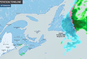
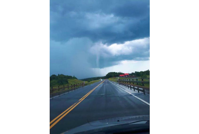
I received one such photo Wednesday. It was taken the afternoon before, Aug. 7, at the height of the active weather near St. Croix, N.S. A thunderstorm watch was upgraded to a warning just after 4 p.m. that day. That’s when this photo was taken by Jody Collins, who wanted to know if that white column was a tornado.
I must preface this by saying it’s very difficult to be 100 per cent certain, based on a still photo, but judging by the radar images at the time and the lack of rotation, it appears to be a rain shaft.
Many people confuse rain shafts with funnel clouds, but they are very different. A rain shaft is a well-defined band of precipitation produced by a convective cloud. It is visible from the ground, quite a distance from the storm. The vertical shaft is made up of rain and sometimes hail and is usually localized over a fairly small area.
The shafts are most often associated with downward air motion. That downward motion can be the result of falling precipitation that drags air downward or the product of evaporative cooling. If the air below the cloud base is not saturated, then there is evaporation that produces cooling in the rain shaft. Cool air is denser than surrounding warmer air and accelerates as is rushes downward. If the conditions are just right, downbursts can produce winds of up to 150 km/h as they hit the ground and spread out. These downbursts, also known as microbursts, can bring down large jets. On land, there can be a substantial amount of damage as a result of one of these microbursts.
When you see something that looks like a downdraft but could be a funnel cloud, always err on the side of caution and take shelter. Putting yourself in harm’s way for a cool photo is never worth it.
Stay safe and remember to always keep an eye on the sky!
if you happen to spot something interesting, take a photo and send it along to [email protected]
Want more weather information? Visit WeatherByDay.ca
Cindy Day is the chief meteorologist for SaltWire Network.