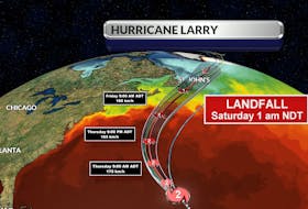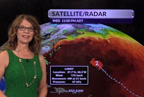
Hurricane season is at its peak in the Atlantic Basin. After a slow start, tropical activity is heating up. On Sept. 20, less than one week after Dorian made landfall in Nova Scotia, many watched as Hurricane Humberto headed our way. Humberto was projected to slide south of Sable Island Friday afternoon then track south of the Avalon very early Saturday morning. Thankfully, this storm offered no surprises.
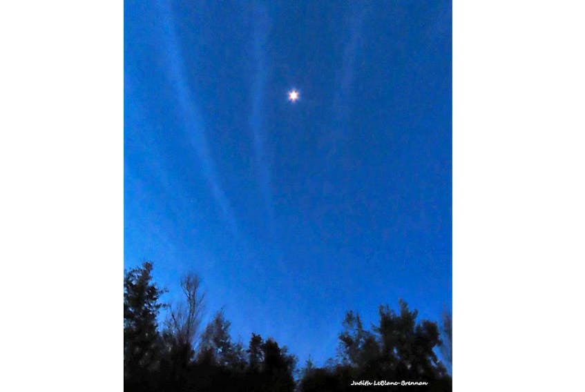
Friday morning, as the powerful cyclone churned hundreds of kilometres offshore, Judy LeBlanc-Brennan spotted something quite interesting in the pre-dawn sky and posted this on my Facebook page:
“…When I stepped out to go for a walk this morning around six and it was still a little dark I could not believe the sky!! There were stripes of clouds across the sky. I even had to get my husband out to look at it. I took a picture but my camera does not take good pictures in the dark. I hope someone else noticed the sky this morning.”
Judy that was Humberto. Despite how things appear on weather maps, a hurricane is more than a point and its path is more than a line. It is a large system that spreads out over a very wide area. The main parts of a hurricane are the cloud and rain bands on its outer edges, the eye, and the eyewall. Air spirals in toward the centre in a counter-clockwise pattern, and out the top in the opposite direction. In the very centre of the storm, air sinks, forming the cloud-free eye. The storm’s outer cloud bands can extend several hundred kilometres from the eye.
These bands form the outer-most fringes of the tropical cyclone structure. They can be 500 km long and very impressive to watch as they slowly spiral overhead.
I’m so glad Judy noticed these far-reaching spokes as they brushed by Cape Breton before the sun came up Friday morning.