May 30, while most of us were slathering on the sunscreen, residents of Newfoundland’s Avalon Peninsula were experiencing less-than-pleasant conditions. It’s not unusual for the weather across the Maritimes to be different from the weather in Newfoundland and Labrador, but this was exceptional. At 3 pm on the 30th, it was sunny and 23 C in Edmundston, N.B., but only 3 C in St. John’s, N.L., with high winds and heavy rain.
The rain and wind storm was special: it was an extratropical cyclone.
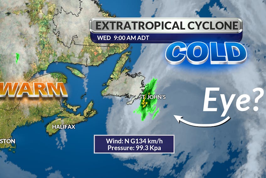
Extratropical cyclones develop when a wave forms on a frontal surface, separating a warm air mass from a cold air mass. We watched that happen May 29. As the amplitude of the wave increased, the pressure at the centre of the disturbance dropped, eventually intensifying to the point where a cyclonic circulation began.
Extratropical cyclones have cold air at their core and get their energy from the release of potential energy when cold and warm air masses interact. An extratropical cyclone can have winds as strong as a hurricane. On Wednesday, wind gusts reached 134 km/h at Cape Race, N.L.
These storms can occur over land or ocean. One of Canada’s most infamous examples took place on Nov. 10, 1975. An extratropical storm on Lake Superior contributed to the sinking of the SS Edmund Fitzgerald near the Canada-U.S. border, 15 nautical miles northwest of the entrance to Whitefish Bay.
- Read more Weather University columns.
- Have a weather question, photo or drawing to share with Cindy Day? Email [email protected]
Cindy Day is the chief meteorologist for SaltWire Network.